

The burned area mapping service (NOFFi-OBAM) has been systematically applied during this year’s fire season, mapping burned areas after large wildfires (larger than 100 ha, although they several smaller ones were eventually also mapped).
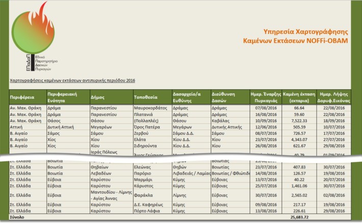
A total of 30 fires were mapped in Greece during this year’s fire season, with a total burned area of 25,683.72 ha. In addition, the burned areas from the two large wildfires in Cyprus (Solea region in the Troodos Mountains and Argaka) were mapped, within the context of the ongoing collaboration between FMRS and the Remote Sensing & Geoenvironment Laboratory of the Cyprus University of Technology (CUT).
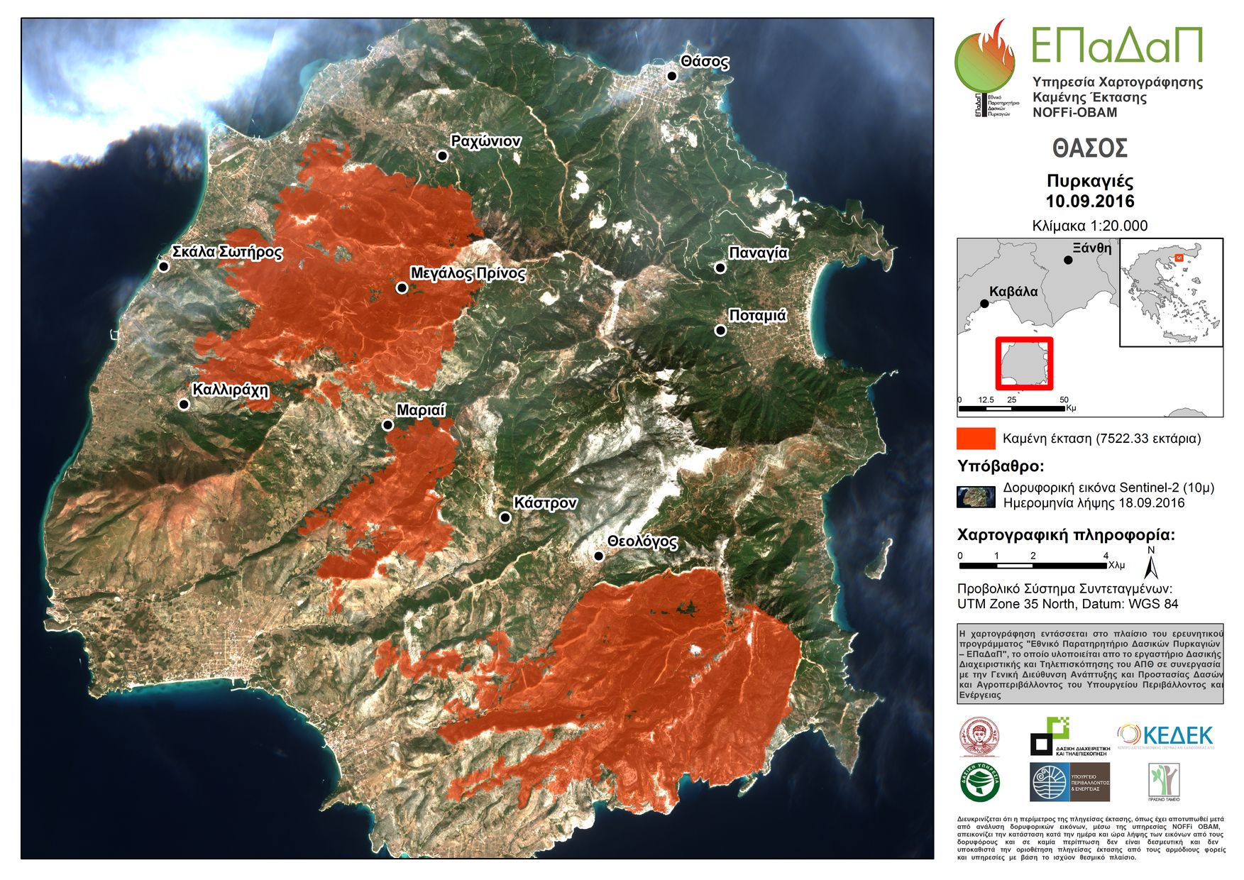
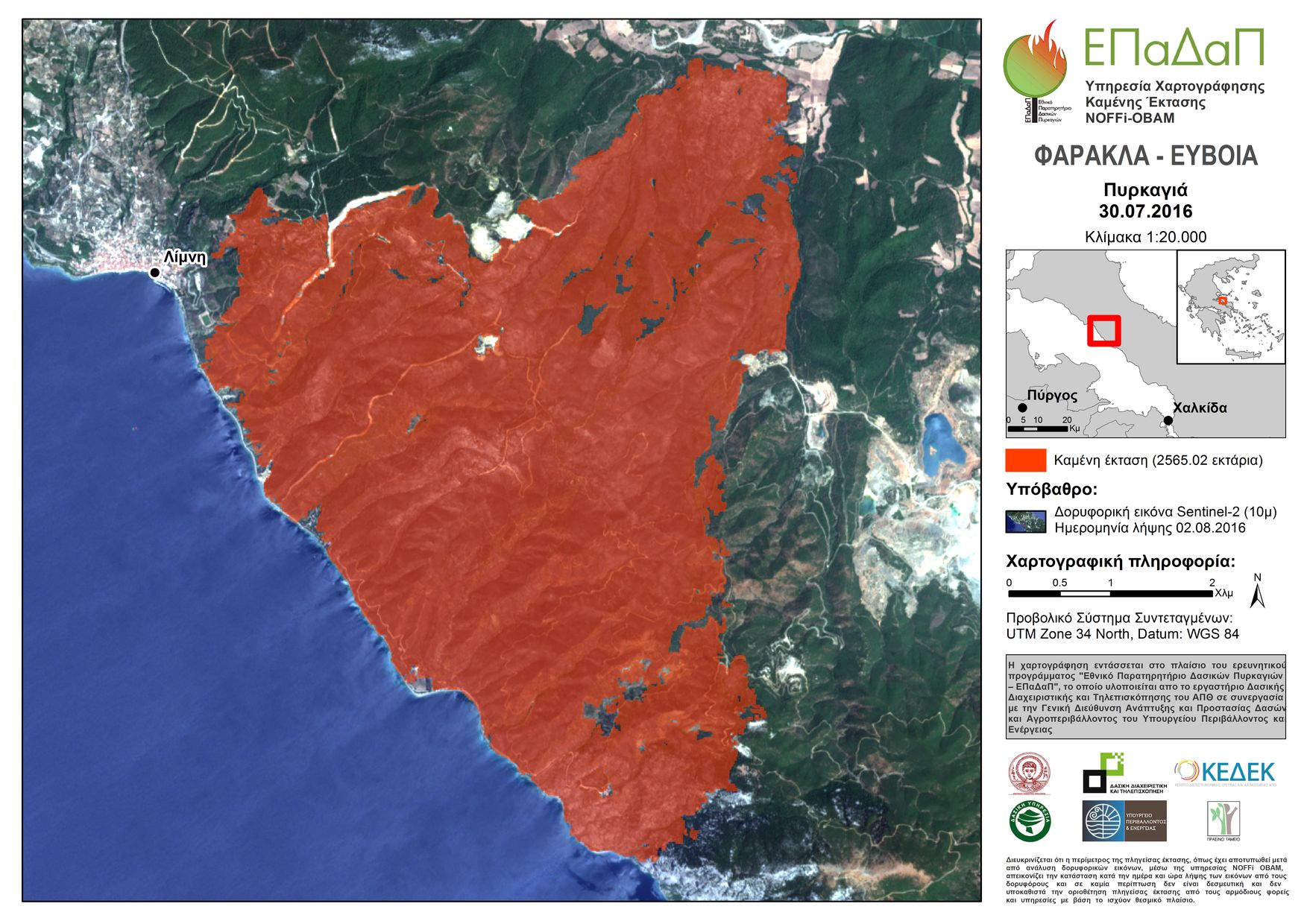
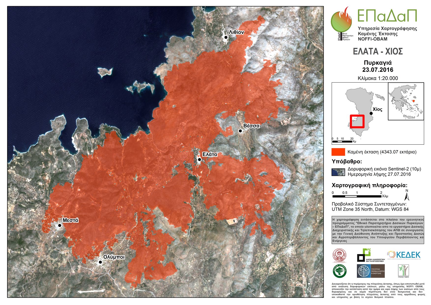 Almost 30% of the burned areas in Greece this year were the result of the multiple wildfires that started almost at the same time on Thasos Island on September 10, 2016 and are believed to have been caused by thunders during a dry storm. More specifically, 7,522.33 ha of forest, farmland and grassland were burned, accounting for about 20% of the island’s entire surface. Other examples are the two destructive wildfires in Chios (Elata area where 4,343.07 ha were burned and Siderounda area where 621.67 ha were burned) and in Farakla of Euboea (2,565.02 ha burned), which caused not only natural damage, but significant financial one as well.
 The NOFFi-OBAM service is employed on behalf of the Central Forest Service (Directorate General for the Development and Protection of Forests and Rural Environment of the Hellenic Ministry of Environment and Energy), but the results have also been distributed to other stakeholders, such as the General Secretariat for Civil Protection, NGOs such as WWF-Hellas and OMIKRON in Chios, as well as the local forestry offices.
The mappings are produced using an advanced methodology that exploits Sentinel-2 satellite data, provided free of charge from the European Space Agency (ESA) under the Copernicus Programme. The data have high definition (pixel size of 10 m for the most important bands and 20 m for the others), whereas at least one satellite image is received and distributed for each area every 10 days. 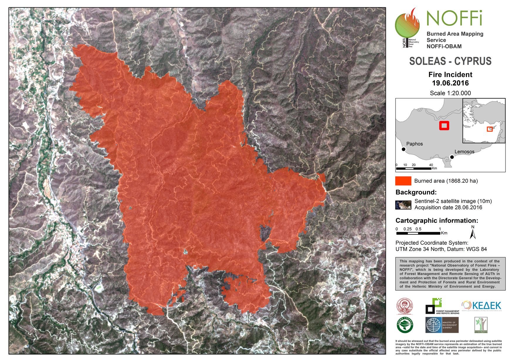 For the 30 fires mapped this year, the average time from the start of the fire to the mapping was calculated at 9.37 days, while the median value was 8 days. This time is expected to decrease significantly with the operation of the second Sentinel-2 satellite, which is scheduled for launch in the spring of 2017.