

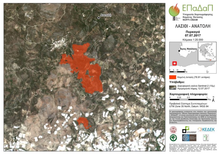
The burned area mapping service (NOFFi-OBAM) was employed to map the recent fires in the region of Lasithi, Crete. The analysis was conducted using a Sentinel-2 satellite image (spatial resolution of 10 m), acquired on July 12, 2017. The mapping revealed that a total of 140.15 ha of forest, farmland and grassland were burned.
It should be noted that the NOFFi-OBAM service is systematically employed during this fire season and its results are being exploited by the Central Forestry Service (Directorate General for the Development and Protection of Forests and Rural Environment of the Hellenic Ministry of Environment and Energy), the local forestry offices, as well as the General Secretariat for Civil Protection.
The burned area map was produced using Sentinel-2 remote sensing data, provided by the European Space Agency (ESA).