 The fire danger estimation constitutes a key element for rational fire management and is closely related to various factors, such as meteorological and topographic data. These factors are used as inputs in the fire danger rating systems for the quantification of the possibility of fire occurrence in the future.
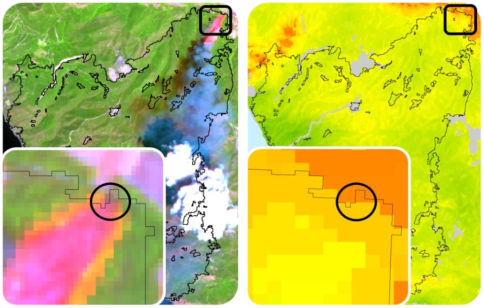
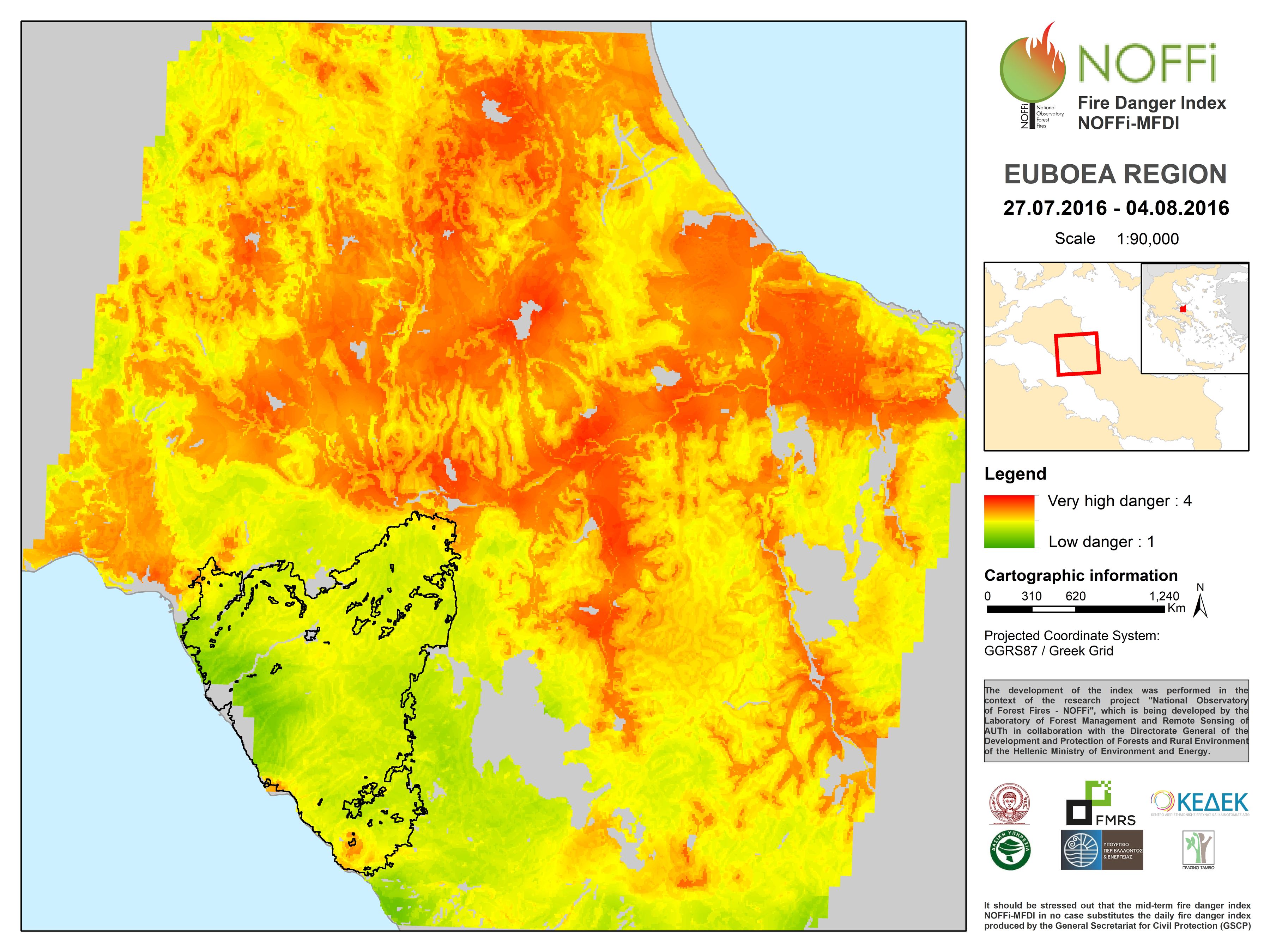
Contrary to the daily fire danger index provided by the General Secretariat for Civil Protection, the methodology developed in the framework of NOFFi provides midterm predictions, which characterize the whole period of the following 8 days. Moreover, it is not based on meteorological data but exploits medium resolution satellite imagery and ancillary geographic information for the reliable fire danger estimation. The calculation of the index is automatically performed within the R open source environment. The fire danger is classified into four categories: 1=low, 2=moderate, 3=high, 4=very high.
Main attributes of the methodology:
- Processing of MODIS satellite time-series for the estimation of vegetation dryness.
- Spatial estimation of dry fuel connectivity.
- Combination of the derived satellite-based measurements with fuel type, topography, and land use (proximity to agricultural areas or the road network etc.) through a multi-criteria analysis scheme for the estimation of fire danger.