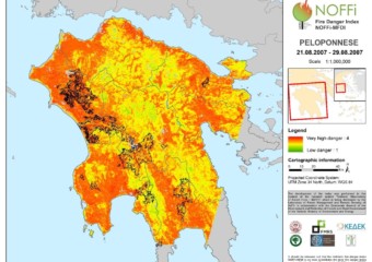
The National Observatory of Forest Fires (NOFFi) got a distinction by the Network of European Regions Using Space Technologies (NEREUS) for the development of the innovative burned area mapping service NOFFi-OBAM.

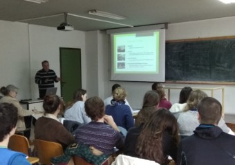
NOFFi Presentation within the context of an academic training tour
NOFFi’s products and services were presented on January 17, 2018 to students from Bordeaux Sciences Agro institute by FMRS team members, within the context of an academic training tour to the School of Forestry and Natural Environment.
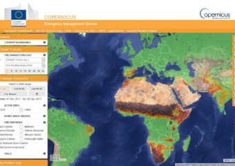
FMRS contributes to the Global Wildfire Information System (GWIS)
FMRS becomes a GWIS ‘Partner and contributing organization’. The Global Wildfire Information System (GWIS) is a joint initiative of the GEO and the Copernicus Work Programmes. The Global Wildfire Information System (GWIS) aims at bringing together existing information sources at regional and national level in order to provide a comprehensive view and evaluation of fire regimes and fire effects at global level.
GWIS builds on the ongoing activities of the European Forest Fire Information System (EFFIS), the Global Terrestrial Observing System (GTOS) Global Observation of Forest Cover – Global Observation of Land Dynamics (GOFC-GOLD) Fire Implementation Team (GOFC Fire IT), and the associated Regional Networks, complementing existing activities that are on-going around the world with respect to wildfire information gathering. The development of GWIS is supported by the partner organizations and space agencies. Support to GWIS was just launched by NASA through its ROSES program.
Access to worldwide information on wildfires is available through the GWIS viewer at http://gwis.jrc.ec.europa.eu/static/gwis_current_situation/public/index.html